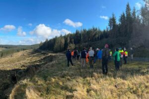
Bluesky is a sponsor of the 2018 National Tree Officers Conference (NTOC).
The Bluesky National Tree Map (NTM) identifies the location of more than 280 million trees nationwide, detailing their height and canopy cover. The data was created using innovative algorithms and image processing techniques in combination with the most up-to-date and detailed aerial photography and height data. A team of experienced professionals completed an exhaustive QA process to ensure the quality and accuracy of the data.
In addition to the three vector map layers; Crown Polygons, Idealised Crowns and Height Points, the NTM also includes an attribute table including unique identification for each crown feature, height attributes and area calculations. The data is available in a range of Geographical Information System (GIS) formats with flexible annual licencing.
Applications of the NTM include subsidence risk assessment by insurance companies, propagation modelling for telecommunication infrastructure planning, network resilience assessment for utility companies and carbon reduction planning for environmental projects as well as general asset management. Existing users of the data are already reporting significant improvements in day to day planning and operational efficiency.
For example, Tamworth Borough Council uses the data to help protect important amenity trees. An eight time gold-winner of national Heart of England in Bloom competition, the Bluesky NTM is helping the identify, manage and protect trees, including those subject to Tree Preservation Orders and other planning constraints. The tree map data is accessed via the authority’s GIS and is available to all staff via its Web Mapping Service (WMS).
The Bluesky tree data was also used as part of a recent Progress and Impacts Study by one of England’s original Community Forest projects and the largest environmental regeneration project in Bedfordshire; the Forest of Marston Vale.
As a result, it was concluded that tree cover had already increased to 15 percent, half of the overall target, with woodland cover up to 11 percent. Based on this ‘forest cover’ data, the study was then able to evidence that every £1 spent in creating The Forest to date had returned £11 in benefits to the area through improvements in employment, health and wellbeing, air quality, recreation, enhanced landscape, property values and, in due course, timber supply.
“While our own data and Forestry Commission data had their merits, neither was as accurate, comprehensive or as up-to-date as the Bluesky tree map,” commented James Russell, Forest Director of The Forest of Marston Vale. “The use of the Bluesky data not only gives us critical data to assess our progress, but it also allows us to evaluate and quantify the benefits of this increased ‘forest cover’ to the local community.”
Other real-world applications of the Bluesky tree map data include use by Dudley Metropolitan Borough Council to help ascertain numbers for a borough-wide inventory of trees, by Exeter University and the Met Office to create the first high resolution maps of allergenic plants and trees and by Daventry District Council to prepare for a new grounds maintenance contract.
Bluesky National Tree Map is currently available for England and Wales with work already underway to create coverage for Scotland.
Disclaimer: The views and opinions expressed in this article are those of Bluesky and do not necessarily reflect the views of the Institute of Chartered Foresters.