Manage the urban forest, online, on any device, in real-time.
Urban Tree Canopy (UTC) analysis and tree inventories are, respectively, top-down and bottom-up assessments. Cities use inventories to improve management and maintenance, and they analyse UTC to develop a benchmark, inform master plans, prioritise, and monitor change. As a natural progression with innovations in mobile technology, urban forest data are being incorporated into online mapping tools.
Tree Inventory Software – Online
Smartphones and tablets help foresters and arboriculturists maximise benefits and minimise costs from efficiency in methods to assess, manage, plan, implement, track, and monitor urban trees. Users can access data from anywhere and manage GIS (geographic information system) tree inventory information, planting activities, volunteers, or work orders – and even view their entire urban tree canopy – all without knowing they’re actually ‘doing GIS’. Browser-based mapping software allows multiple users to edit and report on information in real-time through maps and dashboards. GPS (global positioning system)/GIS are not required. Users simply map a tree’s location from aerial imagery to create x/y coordinates and then inventory location, species, DBH (diameter at breast height), condition, maintenance needs, and defects. Online reports summarise tree quality, diversity, ISA Tree Risk Assessment Qualifications (TRAQ), planting sites, and monetary ecosystem benefits from i-Tree.
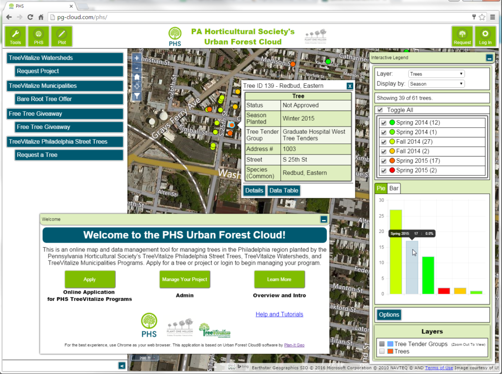
The Pennsylvania Horticultural Society (PHS), founded in 1827, runs the Plant One Million initiative; the largest multi-state tree campaign in the nation. They recently moved 26 spreadsheets into The PHS Urban Forest Cloud (https://pg-cloud.com/PHS) to streamline the process of collecting and managing tree health monitoring data and new tree planting requests. No longer on paper forms and submitting to PHS, neighbourhood Tree Tenders’ groups now leverage the new tool on smartphones or tablets. With an electronic tree application form, it is much more convenient for Tree Tenders to get their neighbours signed up for a tree and easier for PHS to submit that information to the City for required permits. All data is now standardised, stored in a central location, and viewable by staff and group leaders. A live dashboard summarises species composition and results on new trees performance and care.
Urban Tree Canopy Assessment – In the Cloud
Geospatial analysis of LiDAR and multispectral imagery is used to assess UTC, a key performance metric and indicator of urban environmental health. A baseline of existing canopy and potential planting areas helps to identify priority projects, address underserved areas improve equitable distribution of canopy, and identify partners.
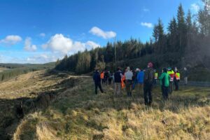
Keep Indianapolis Beautiful (KIB), a not-for-profit organisation based in Indiana, engages diverse communities to create vibrant public places, inspire people and help nature to thrive. KIB identified the need for a strategic planning tool to develop partnerships, educate on the value of greenspace, build social capital, and a better ‘tree culture’. KIB funded the development of a cloud-based application to view, plan, and grow the region’s tree canopy (https://pg-cloud.com/KIB). GIS prioritisation uses existing canopy and plantable space, vulnerable populations, urban temperature data, impoverished areas, and other criteria. KIB also migrated tree planting, volunteer, and project data to the cloud. Staff can now access tree data and detailed project and volunteer information from a tablet, not just GIS specialists from their desk. Expanding functionality to all staff allows KIB to be consistent and efficient with data collection for better integrity and reporting.
To the Cloud!
Tree inventories, ecosystem services analysis, prioritisation, and real-time urban forest dashboards have never been easier or this powerful. Urban forestry software should be like the intern or executive assistant you always wanted… easy to work with, accessible anywhere anytime, fast, and data-driven.
Ian Hanou is the Founder of Plan-It Geo and has been working in GIS, project management, software development, and urban forestry for over 15 years. He will address the Trees, People and the Built Environment 3 (TPBE3) conference in Birmingham on Thursday 6th of April.
Read related articles, additional case studies, and more at:
- https://issuu.com/planitgeoissuu/docs/web-mobile_tree-inventory-software_
- https://issuu.com/planitgeoissuu/docs/online_tree_planting-plan-it-geo_ia
- www.TreePlotter.com
Disclaimer: The views and opinions expressed in this article are those of the author and do not necessarily reflect the views of the Institute of Chartered Foresters.